
This is bizarre – the Bossert Hotel, which has been under renovation since 2012 – still has no operator. Fën Hotels was chosen as the operator in 2015 but they have no backed out and the developer is now searching for a new operator. The hotel was slated to open in 2013, so it is now delayed by 5 years, with the developer citing vague issues with interior restoration (the building is not an interior landmark, but could have been a good preservation tax credit project).
Inn Inching Along
Dime Savings Bank to be Landmarked
At a public hearing yesterday, the Landmarks Preservation Commission took another step toward landmark designation for the Dime Savings Bank of Williamsburgh. Among those speaking in favor of designation were the building’s owner and the Historic Districts Council.
The bank building on Havemeyer Street was constructed in 1908 and design by the architecture firm Helmle & Huberty. The building is the second home to Dime (originally they were on Broadway and Wythe). After the construction of the Williamsburg Bridge in 1903, many of Williamsburg’s banks moved from lower Broadway and Grand Street to the newly-created Williamsburg Bridge Plaza. The plaza itself never became the grand public space that one would expect for this era of the City Beautiful and Beaux Arts era, but did become home to a number of monumental buildings, including the Williamsburgh Trust Company, the Dime Savings Bank, Northside Savings Bank and the First National Bank.
It is nice to see Williamsburg get a bit more attention from LPC, but as one of the oldest and most richly layered neighborhoods in New York, we definitely get short shrift. Meanwhile, Manhattan continues to be carpeted with historic district designations.
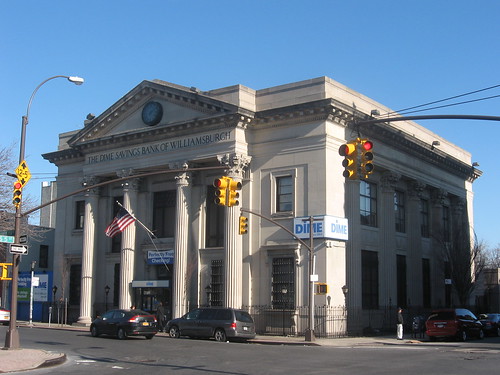
Dime Savings Bank of Williamsburgh (1908, Helmle & Huberty architects)
[Photo: Matthew X. Kiernan, via Flickr]