Riverside Interludes, Far From the Madding Crowd

The Times discovers the magic of Grand Ferry Park:

the fleck of a park that the local residents know as one of the few places amid the soaring condominiums and fenced-off industrial lots of Williamsburg where one can steal time with the water, separated from the concrete by no more than a jumble of boulders.

One of Williamsburgh’s first ferry services to Manhattan was located here as early as 1814 (steam service arrived in 1827), but as the article notes, it has been almost a century since there were any ferry boats stopping here.

And it is not really set in nature, not with the old Domino Sugar Factory on the left and the fenced-in warehouses, whatever they hold, on the right. It is not really quiet, either, not with the drone of nearby machinery pulsing at all times. But it feels quiet.

What they hold (and what is making the noise) is a small gas turbine power plant, constructed by the New York Power Authority in 2001 or so.
Ugliest, Scariest, Most Horrible

The last thing Greenpoint ever wanted was a wall of buildings. This is the ugliest, scariest, most horrible plan.

It would have been great if all these people cared back in 2004 or so when all of this was getting approved. Olechowski is right – there was a lot of activism within the community to get a better plan out of the rezoning (going back to the mid 1990s), but what was approved is what was approved.

And except for the height of 77 Commercial, just about everything here is what was approved in 2005. And the height of 77 Commercial has an actual community benefit attached to it – a new park next door at 65 Commercial. Whether that is a trade-off worth making is another question.

Greenpoint Landing Lands Tonight

Park Tower Group Greenpoint

Greenpoint Landing (via Crain’s)
Architect: Handel Architects

Greenpoint Landing – the 22-acre development at the north end of the Greenpoint waterfront – is scheduled to make its public debut at a Community Board 1 meeting this evening*. From what I’ve heard to date, the project itself is largely as of right – the number of units, tower heights, tower massing, etc. are all what was approved in the 2005 waterfront rezoning (as Matt Chaban notes, the development has gone from glassy to a more “contextual” brick with punched window openings).

What is new is that the developer will be constructing the affordable housing that the city had committed to as part of the 2005 rezoning (Greenpoint Landing is building 20% inclusionary on their property, and building additional units on a city-owned site that is being wrapped into the project – the number of affordable units isn’t actually increasing from what was promised). The other new thing is the inclusion of a school as part of the development – this latter bit might be the only thing that requires an actual zoning modification.

There is another item on tonight’s agenda that will require a zoning modification – the new development up the street at 77 Commercial Street. That project is acquiring the air rights from the MTA parcel at 65 Commercial Street. The air rights purchase will allow the city to construct the park it committed to build at 65 Commercial, but also certainly taller and bulkier development on the adjacent 77 Commercial site.

The Greenpoint waterfront has been aslumber ever since the 2005 rezoning was approved (eight years ago this week). Greenpoint missed the last real estate boom, but seems destined to get caught up in this one, and when that happens, it will make the Northside and even Long Island City look quaint by comparison.

*Pardon the Facebook link – CB1’s website is too useless to link to.

It’s Much More Local than Williamsburg

Whatever that means – I guess anything in Greenpoint is more local to Greenpoint than Williamsburg.

Sometime pretty soon, development along West Street is going hit. And when that happens, Greenpoint (this section at least) is going to look a hell of a lot like Williamsburg. And like Long Island City.

Schizo Skyline

Stephen Jacob Smith is back, this time arguing that Two Trees’ Domino plan is somehow flawed because the upland zoning in Williamsburg is not dense enough. Where to begin – again?

But despite the best efforts of SHoP and Two Trees, the plan does not succeed in aping the natural parabolic shape of an organic thicket of towers found in midtown, downtown or even downtown Brooklyn. Nor could it—Williamsburg’s new planning regime, instituted in the 2005 rezoning and reinforced in 2009, makes sure of that…

A block or two away from the old Domino refinery, the skyline plummets to near zero—most sites across the street are zoned exclusively for industrial use, and cannot be developed beyond one and two stories. There is no gradual downward gradient.

Because the 2010 Domino zoning was a spot zoning – a really large one, but still spot zoning. When originally proposed in 2006 or so, the Domino rezoning actually included most of the surrounding industrial blocks. This made sense since the only reason those blocks were left out of the 2005 rezoning was because at that time Domino was still operational and had no plans to cease being so. Why did CPCR and the City take those blocks out – I have no idea, but it certainly wasn’t because of local “anti-growth” attitudes.

A block away, however, Mr. Smith’s dreamland actually does exist. East of Wythe Avenue, the Southside is zoned for medium to high density, largely without height limits. Because this area does have a lot of larger 6-story new-law tenements, it was not part of the 2009 contextual rezoning. This same context – R6 zoning with no height limits – also exists out along the L train in Bushwick. But not in between:

High-density building is allowed more than half a mile from the Bedford Avenue L, on the waterfront, but no housing is allowed at all on the blocks immediately adjacent to the Morgan Avenue stop. And it’s the pre-war neighborhoods, which sprouted naturally closest to the L, where residential development was most restricted in the rezonings.

OK – first of all, development did not sprout “naturally” along the L train. The L train was constructed as the Canarsie Line in the mid 1920s – well after 90% of the surrounding development, particularly that in the Northside, was constructed. The L train was a late addition, meant in part to connect the existing working class and industrial neighborhoods of Brooklyn to one another (and to Manhattan). One of those industrial neighborhoods was near the Morgan stop. That area is zoned industrial because it is a historically industrial area directly adjacent the canals of Newtown Creek and the LIRR freight spur. Maybe that zoning is outdated (I don’t think so, though I do think many other industrial areas are), but singling out one subway stop when the five stops before and the five stops after are in largely residential zones (some without those pernicious height limits) seems like cherry picking.

Northside

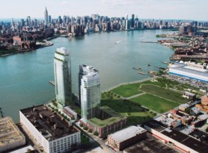
Looking at the photo to the right, you might be forgiven for thinking Smith has a point. But contrary to what the caption says “density differentials” are not that “par for the course on the waterfront.” The photo itself isn’t even real – it is clearly a rendering (by Toll Brothers, I assume) showing the full build out out of Northside Piers (the tower at left is just now under construction). To the north of Northside Piers is the Edge (3/4 of which is built out) and beyond that a park (because when you rezone a neighborhood for a population increase of 30,000, it helps to add some open space). And to the north of that is some low-scale industrial stuff that is also slated to become a park (that’s another story). Meanwhile, across Kent Avenue, most of the low-scale blocks shown in this rendering have been redeveloped or are in the process of being redeveloped, for 6- to 7-story residential. Even the hulking block-long building to the south of Northside Piers has been redeveloped – it now houses 242 residential units. All told, there are well over 1,000 new housing within two blocks of Northside Piers that are not shown in this image, and the density (not height) differential between the buildings on one side of Kent and those on the other is not really that dramatic.

This trope that low-scale neighborhoods are de facto low density is getting really tired, and no matter how many times Smith says it, it doesn’t make it true. As I pointed out the last time Smith raised this idea, there are actually a lot of unused development rights within the existing zoning for Williamsburg and East Williamsburg. A quick back-of-envelope calculation shows that much of the area is built to about two-thirds or three-quarters of its allowable floor area. And that’s just the existing housing stock – the two to (usually) three or four story vinyl-clad houses Smith abhors (but which, interestingly, people are willing to pay dearly for, and use as is, even when they are underbuilt by 50% – stupid market).

And this doesn’t begin to take account of the thousands of housing units at “projected development sites” identified in the 2005 rezoning that remain unbuilt. So even without rezoning for increased density, there is a lot more density to come. And capacity for plenty more built into the system.

New new Domino Plans Revealed

Cheap sugar

Taller… and cheaper?


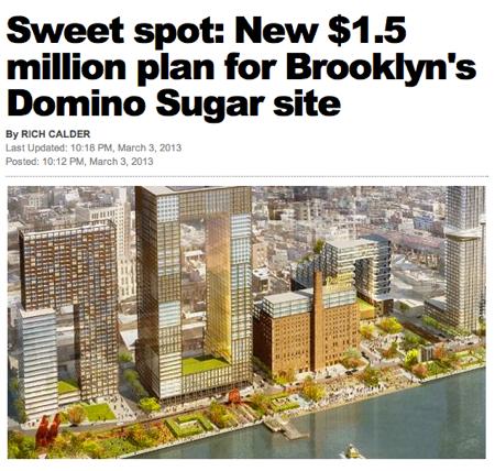
In case you missed it, the new new Domino plans went public late this evening. There is a lot to digest here, including taller buildings, a lot more architecture, more open space, a whole new street, a lot more commercial space, a little less residential space, the same amount of affordable housing. And, according to the Post headline writers, Two Trees has really figured out how to economize on construction costs.

Like I said, a lot to digest here. But in the end, it comes down to a question of: is it better?

Greenpoint Landing – Yes, It’s Coming

Greenpointers needs to stop being shocked – SHOCKED! – that massive high-rise development is coming to their waterfront.

Since 2005, it has been a question of when, not if, the Greenpoint waterfront will look like Long Island City, Northside Piers, the Edge, Schaefer Landing and all the other towers-to-be that will one day line the East River.

Billyburg Parents’ Ship Comes In

Williamsburg’s growing population of parents with young children will soon have a new entertainment option. New York Kids Club, a privately-held enrichment day camp, preschool and party site is in the final stages of buying the retail condominium at 2 Northside Piers…

Kennel, wine store and day care all in the same development – great news for parents. And for people who like every development to have the same retail options.

Above the Flooded Plain – Did New Waterfront Developments Fare Better?

Sandy’s high tide receded, and the buildings on the waterfront in Long Island City stood like sentries on the coast—dry, fully inhabited and powered up almost as though no superstorm had ever occurred.

The situation was much the same in Williamsburg, best as I can tell. The new buildings came through relatively unscathed, despite flooding around them. I don’t know if any of the new Williamsburg buildings took special measures to mitigate 100-year flood conditions, but I know that 184 Kent did, and they worked.

One caveat here (and in LIC) is that the flooding was relatively light. There was definitely flooding, but compared to what was happening across the river and in places like Red Hook and even DUMBO, we seem to have gotten the least of it. Still, like LIC, none of the Williamsburg waterfront developments had to be taken out of service.